
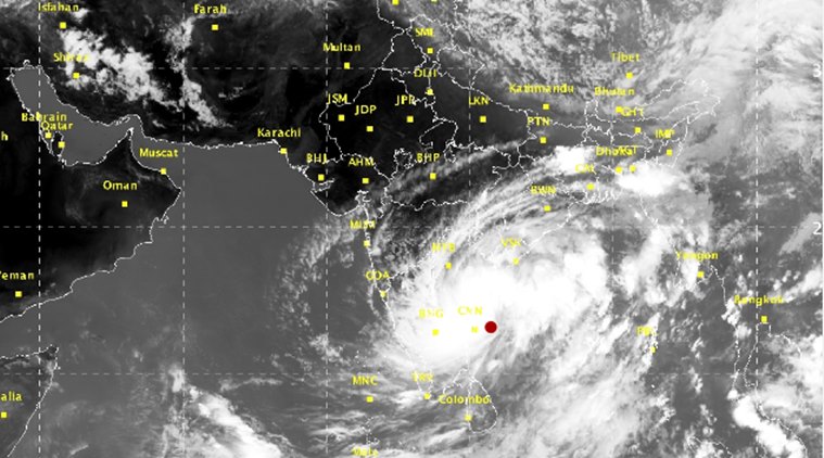
Hyderabad, November 4, 2026: The remnants of Severe Cyclonic Storm Murasu have weakened into a depression over east Telangana and adjoining Coastal Andhra Pradesh, according to the India Meteorological Department (IMD). The system continued moving northwards and was expected to weaken further into a well-marked low-pressure area within the next 12 hours, the department said in its Wednesday bulletin.
At 5:30 am on November 4, the depression was centred near 17.0°N and 80.1°E. The IMD placed it around 30 km northwest of Nandigama, 30 km south of Khammam, 80 km northwest of Vijayawada, 90 km east of Nalgonda and 110 km southwest of Bhadrachalam. The system had moved northwards at approximately 10 kmph during the preceding six hours.
Heavy rainfall remains the immediate concern
Although the storm has weakened, the threat of intense rainfall has not ended. The IMD forecast isolated very heavy rainfall over Coastal Andhra Pradesh and Telangana on November 4, with heavy rainfall possible in parts of South Odisha and South Chhattisgarh. The department also reported extremely heavy rainfall in Telangana and Coastal Andhra Pradesh during the 24 hours ending at 8:30 am Wednesday.
Rainfall may lead to waterlogging, swollen streams, local flooding and disruption to road and rail movement, particularly in low-lying and poorly drained areas. Residents should avoid walking or driving through flooded underpasses and should not attempt to cross overflowing streams. People living near rivers, tanks and vulnerable slopes should follow instructions issued by local authorities.
Wind and coastal conditions
Squally winds of around 40–50 kmph, with gusts reaching 60 kmph, were forecast over parts of the west-central Bay of Bengal along and off the Andhra Pradesh coast for the next few hours, gradually decreasing thereafter. Fishermen and small-boat operators should follow official marine warnings and avoid venturing into unsafe waters until restrictions are lifted.
District administrations, emergency services and power utilities are expected to continue monitoring the situation. Commuters should check local transport advisories before starting long journeys, while farmers should protect harvested produce where possible and seek guidance from local agriculture officers.
What residents should do
Keep phones charged, store drinking water and essential medicines, secure loose outdoor objects and stay away from damaged electric poles or fallen wires. In an emergency, contact the local disaster-management control room rather than relying on unverified social-media messages. The intensity and location of rainfall can change quickly, so district-wise IMD bulletins remain the most reliable source for updated warnings.
Bottom line: Murasu is weakening, but heavy rain, gusty winds and local flooding remain possible across affected districts. Follow IMD and state disaster-management updates through the day.
Sources: India Meteorological Department press release, November 4, 2026; Andhra Pradesh State Disaster Management Authority; Associated Press reporting on the landfall. This article is an update based on official bulletins available at the time of writing.

Comments